Monday, July 15, 2013

Mount Rainier climbing preparation

Mt Rainier from the Wonderland trail
RAMROD
Mount Rainier Route InformationFor the past three years I have been drawn to Mount Rainier.  Two years ago by bike in the RAMROD event; ride around Mt Rainier in one day.  Last year I circumnavigated Rainier on the Wonderland trail.  This year it will be an attempt to summit Mount Rainier.  Summiting Rainier was not something on my bucket list, not something I was drawn to or even thinking about. When my good friend called me and mentioned she was climbing with a teacher friend of hers and two other women and would I be interested in joining them I instantly knew that this was something I wanted to do.  Our guide would be the amazing Lisa Rust a teacher in HR that has extensive guiding experience.  Lisa has guided over 50 summit climbs up Mt Rainier, many expeditions at McKinley and climbed Everest.  If I was going to do this, she would be the one to go with.  I am honored to be asked to go with this strong group of women. 

There was not a lot of training time from the time I was asked, four weeks.  Mt Rainier is known to be the a climb of endurance.  The mountain is 14, 411 feet.  Time to get serious.

Proposed route:
The route to the summit of Rainier traverses across the Cowlitz Glacier, which is in great shape with few crevasses to navigate around. Ascend Catherdral Gap to the back side of Cathedral Ridge to Ingraham Flats. The traverse to Disappointment Cleaver remains straightforward and is followed up by the climb up the 'shoulder' of the Cleaver, switchbacking up the flanks of the ridge until 12,300'. From here the route takes a new turn and climbs terrain seldom seen, heading south towards Camp Comfort near the top of Gibraltar Rock. This entails a traverse that brings us to a ramp that takes us to terrain just above Camp Comfort at 12,800'. From here there are switchback up moderately angled slopes which encounters few of the steep areas our normal route offers. We then meet up with our old route at about 13,900' for the last 300' to the crater rim.

practicing self arrest at Timberline


The climbing plan is to go to Muir camp from Paradise, spend the night. Day two from Muir camp to the summit (if all goes well) back to Muir to pick up our stuff and back to Paradise.  With limited time to train and a full time job I loaded my pack up with 30 pounds and hiked up Dog Mountain; 8 miles and 2,800 feet elevation gain and loss. Beautiful way to spend the morning - but I literally put 30 lbs weight in my bag and with out the weight distribution it was quite uncomfortable.  

My second training preparation was to climb Mt Adams and practice some rope work on the way up.  Early Friday morning we packed our bags and headed up Adams.  On the way up we practice rope work, learned that the rope is what you use to communicate with, practiced right amount of slack, keeping the rope on the down hill side and how to turn; drop rope step over, turn, switch ice axe hand and move the rope behind you up hill out of the way of the person behind you and to do all this while still moving.   We had a successful summit of Adams with a peak at the base of Mt Rainier, the top was in the clouds.  The Mt Adams summit was confidence building for the up coming Mt Rainier adventure.  

I am feeling respectfully excited and nervous about the upcoming summit attempt, hope the good weather holds.

View of Mt Rainier from summit of Mt Adams
More Information:
Mount Rainier Climbing - blog
Climbing Mt Rainier - Backpacking magazine
Yes you can climb Mt Rainier - Outside Magazine

Saturday, July 13, 2013

Mountain Biking the North Rim of the Grand Canyon


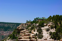
North Rim of the Grand Canyon
Five day mountain bike ride trip on the north rim of the Grand Canyon.  

This past December in the middle of winter I signed up for a mountain bike adventure. I was dreaming of dry heat and expansive views; completely opposite conditions of where I was at that moment.  Winter was quickly over, spring flew by and next thing I knew I was packing for a mountain bike trip in the southwest.  The plan was to drive to St George where the trip started and finished. Early Saturday morning, fully caffeinated, we loaded the truck up with bikes, camping gear and hit the road.  This was a going to be a reasonable road trip, the group I was traveling with decided to break the drive to St George up into two days.

We stopped for the night in Twin Falls Idaho.  After dinner we worked off our steak dinner by walking across the Perrine Bridge, turns out this is one of the few bridges in the US that allows base jumping.  We were lucky enough to witness a base jumper jump.   

Sunday early evening we arrived in St George and it was hot hot hot; the air felt like a hair dryer blowing on high heat on us.  Luckily, our bike rides would be at greater altitudes between 7,500 and 8,900 feet with expected temperatures in the 70 and 80's.  

Day 1:  We met up with our guides and group.  The van was loaded up and we drove to the Kaibab National Forest for a quick shakedown ride to lunch followed by a fun singletrack through aspen and ponerosas pine groves on the Arizona Trail with views of the east rim.  The ride ended at our camp site with expansive views from the north rim of the canyon.  We settled in our camp up for the next two nights.

Day 2:  Woke to a beautiful sunrise soon after the guide yells out COFFEE; very nice start to the day.  We rode about 25 mile out and back on the Arizona trail; lots of short climbs and descents and rode in and out of meadows.  Back at camp we relaxed with happy hour and yummy appetizers, chatted with the other guest.  There were 7 of us; two retired guys from Montana that had a long history of biking, a woman doctor from Alaska and us; my friend from HR, her sister and step dad.  

Day 3:  Transition day.  Pack up camp.  Drove to the Grand Canyon National Park for a hike and visit to the impressive Grand Canyon Lodge located on the edge of the extensive north rim of the canyon.  After exploring the Lodge and trails we headed towards the new camp site with a dirt road ride. The camp site  was on the Rainbow Rim Trail with expansive views of the canyon.


Day 4: The Rainbow Rim Trail was designed for mountain bikers and the inclines and descents are not more than 9% grade.  For me, riding on the this trail was rock star cross country mountain bike riding.  The trail closely follows the rim at some points the trail is right on the rim with indescribable amazing views.  After breakfast and packing a lunch we did an out and back ride to the north with lunch at the turn around point.  Back at the camp site we hiked around, test rode other peoples bike and the guides gave a mt bike skills clinic. After dinner we played a competitive game of traveling boccie ball.
Day 5: Final day.  Early morning sunrise walk to admire the light changing on the canyon walls, coffee, breakfast and then camp pack up; good living!  Last day of riding we rode the Rainbow Rim Trail to the southern end; great cross country riding with stunning views of the canyon. 


Two day drive back to HR, happy, fun trip and not ready to be home yet.  I am inspired to go back to Grand Canyon for more exploration; I see a Rim to Rim hike in my near future.  
More information: Western Spirit
Grand Canyon


Monday, July 1, 2013

Kokanee Glacier Ski Trip - Feb 2013


7 Day ski touring in the Canadian Kokanee Glacier National Park


WOW!  I would have never have thought I would be invited on a back country ski trip in Canada.  I know many really good skier that go on these trips annually.  I just get to see the photos and hear the stories of their adventures.  Of course I would never be invited, I didn't ski.  I didn't grow up skiing or come from a ski family.  I learned to snow board over 10 years, but didn't love it.  What I liked was to be out in the back country exploring.  Four years ago I made the investment, I bought back country gear a season pass and started skiing.  It was not pretty, but I kept at it; Wallowas hut trip, ski clinics, lots of days alone building my confidence.  When I got the email asking if I wanted to go on this trip my first thought was there must be a mistake.  While I can now ski, I am not killing anything on the slopes, I do love to be out in the back country and to climb. 


In February 2013 I drove to Nelson BC with a bunch of skiers loaded our gear into a helicopter and the adventure began.  It was an amazing, challenging, exilerating and fun seven days in the back country.  Each day after breakfast we would venture out into the Kokanee Glacier National Park for skiing adventures.  Before dark we made our way back to the cabin for a few beers and amazing dinners, we repeated this six more times. 


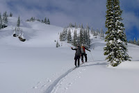
view from the deck of the cabin - scoping our routes


  •  crossing the Kokanee Glacier
  • repeater on the Kokanee Glacier
  • old Kokanee Chief cabin


  • packed up and ready for the helicopter pick up


More Information:
Avalanche information

Fun youtube video - different trip same location

Saturday, January 5, 2013

Circumnavigation of Mt St Helens in one day: part three of the 2012 circle the mountain trilogy

Checking out the trail to Windy Pass


"Hey want to run around Mt St Helens?"  my good friend and running partner asked me as we were hiking around Mt Hood this past summer.  "Sure, that sounds fun", I replied.  This is how I get myself into these adventures, by saying yes and then doing the research.  The trail around Mt St Helens is called the Loowit Trail #216, there are several trails to the Loowit Trail, we chose June Lake based on access to the Loowit trail and our access to St Helens from the south.  Overall, there is 6,700 feet elevation gain and loss around the mountain and it is 30ish miles in length, all very doable for someone with a good fitness level and endurance.  We checked the weather forecasts, pick our weekend and started planning. The day we ended up going was early in October.  We got lucky with the weather, it was warm with almost no wind and completely clear skies.
boulder field trail marker
Our adventure started in the dark around 6:00 am with headlamps on we slowly ran up the June Lake trail to the intersection with the Loowit trail.  It was light out when we reached the Loowit trail and getting warm, we striped our extra layers and changed hats from wool caps to visors for sun protection.  Based on our research we had decided to travel clockwise around the mountain and go through the boulder field first to navigate it with fresh legs. 

The first few miles of the Loowit trail is through a boulder field that is navigated by poles; sight one hike to it, sight the next one hike to it.  It is slow moving.  From the boulder field the trail turns forested and drops 1,600 feet to the Toutle River which is about a third of the way around.  At the Toutle River we filled up our water bladders (treated it with iodine), snacked, applied more sun screen and admired the views.  
looking down at the Toutle River

From the Toutle River the trail is wide open and exposed to the elements, the trail drops in and out of canyons until the blast zone.  We made pretty good time - stopping to admire the views periodically.  


Hiking out from the Toutle River

west side wide open trail - heading north to the blast zone
The blast zone landscape was spectacular, I slowly ran through the flat rocky landscape wishing that we had another day to explore the waterfalls and take in the amazing science fiction landscape.  From the blast zone the trail goes up to Windy Pass, the highest point in the trail elevation 4,950 feet and about two thirds of the way around the mountain.  Before you get to Windy Pass there is a good place to refill your water - we waited until Ape Cave, this was a mistake because the water source there had dried up since late August and I ended up finishing the hike without water.
blast zone trail marker
Spirit Lake with Mt Rainier in the background
Heading through the Plains of Abraham
How lucky, no wind!  Dropping down from Windy Pass to Plains of Abraham on to Ape Cave we made really good time.  The trail is mostly flat and easy to navigate.  Just 5 miles to June Lake trail junction from the Ape Cave trail.  Based on the time we were making we started making dinner plans.  A bit too optimistic - the last 5 miles is very deceptive and turned out to be our slowest of the day.  The trail drops in and out of canyons and the canyons go on forever, even though it is a net down hill that last 5 miles was very, very slow going.  Once we reached the June lake trail junction it was a quick downhill to the car - still light out, still smiling and ready for dinner.


More Information about running the Loowit Trail in one day:
Loowit Trail #216 route around Mt St Helens
Volcanic 50K run
Info on running around Mt St Helens
more info on running around Mt St Helens